Tips to use Nakasendo Trail maps even in Offline (PDF&MapsMe)

The Nakasendo trail is complex, so we share detailed walking routes Map and Wi-Fi spot Map on our site with Google Maps.
However, when you are in Japan, you may lose Internet access and may not be able to see Google Maps.
To prevent such a situation, this article will show you how to save Google Maps information on your smartphone so that you can view it even offline.
Two ways to use the Nakasendo Trail map offline
There are two ways below.
| Way | Advantage |
|---|---|
| “MapsMe” App | Can save detailed data. Can display your current location on the map Voice guidance is available |
| PDF Map | Easy to use Easy to share with your team Easy to print |
Nakasendo Maps PDF download
Simply download and use the PDF map!
Setup to Use the Map offline with “MapsMe App”
“MapsMe” allows that using offline and installing the date of Google My maps.
So, you can use Nakasendo Maps even under offline,by installing Google My Maps data on MapsMe maps.
The procedure is below 3 steps
Download MapsMe App

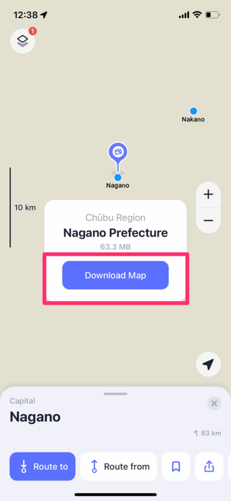
Download “Nagano Prefecture” Map on Maps.Me
The Nakasendo Trail is located in “Nagano Prefecture”.
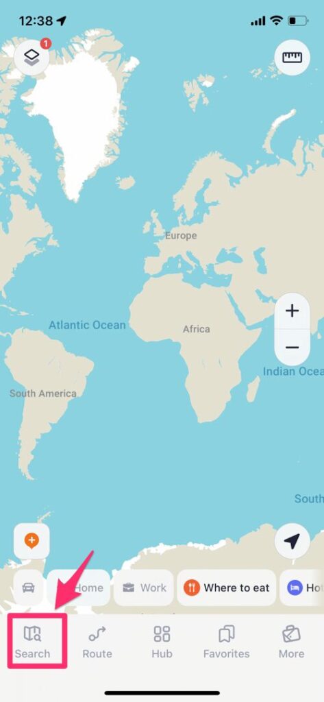
Tap “Search” buttan in the lower left corner and put in “Nagano”.
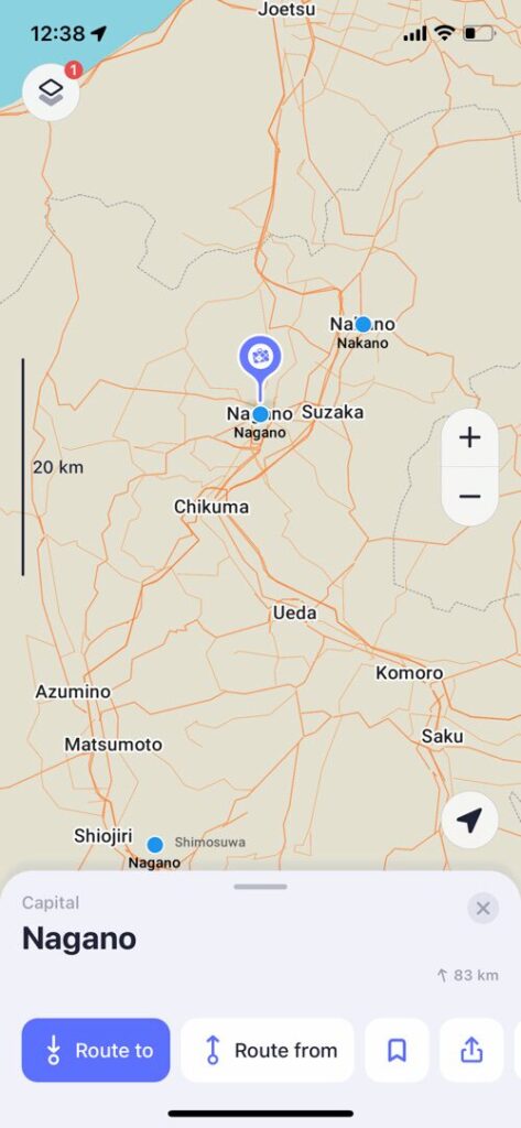
When the map of Nagano appears, pinch in.
You will then see a button to download the map.
Download Google My Maps data & Install on Maps.Me
Goto Google Maps.
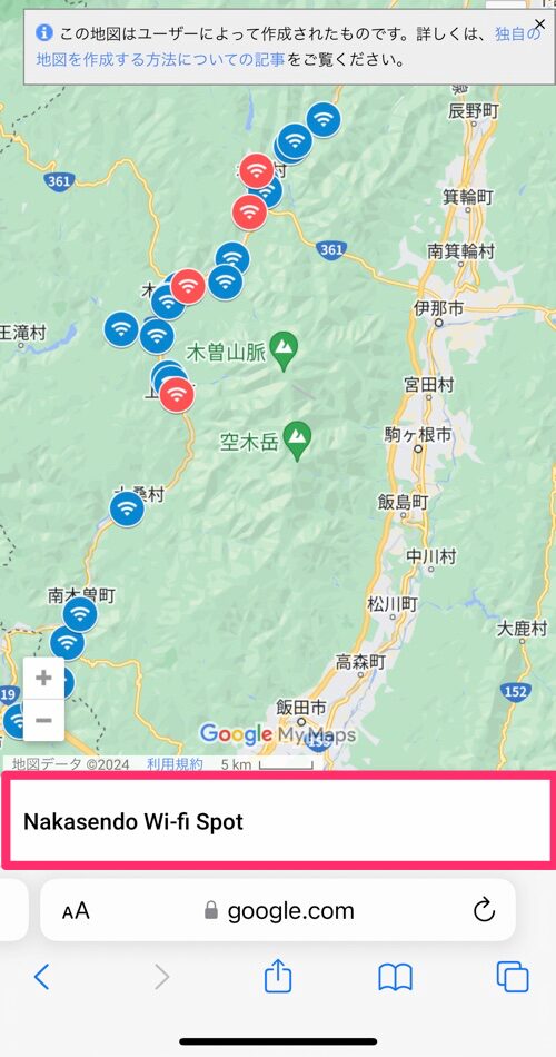
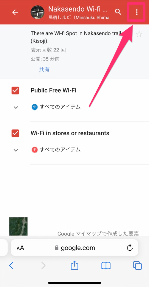
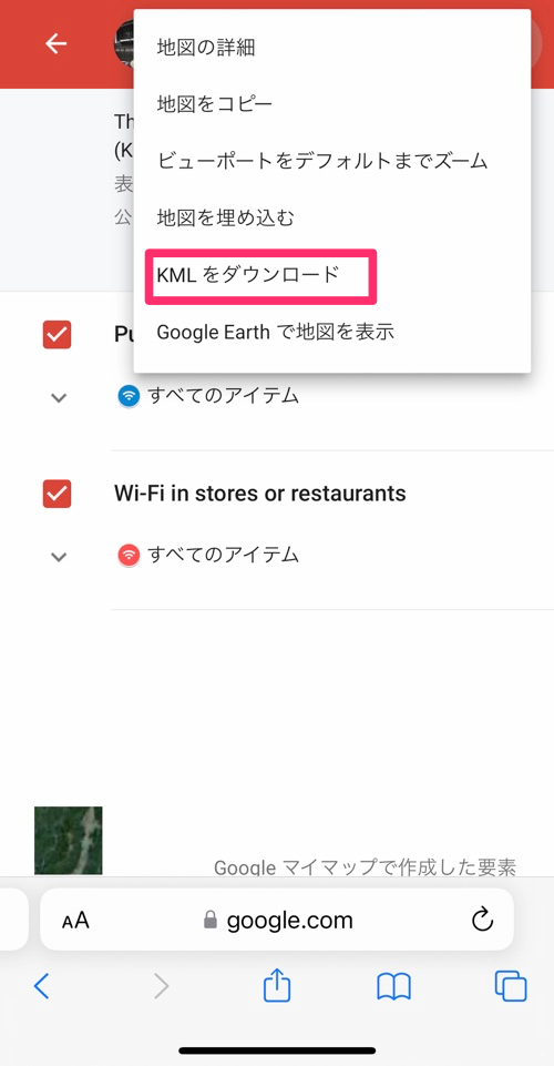
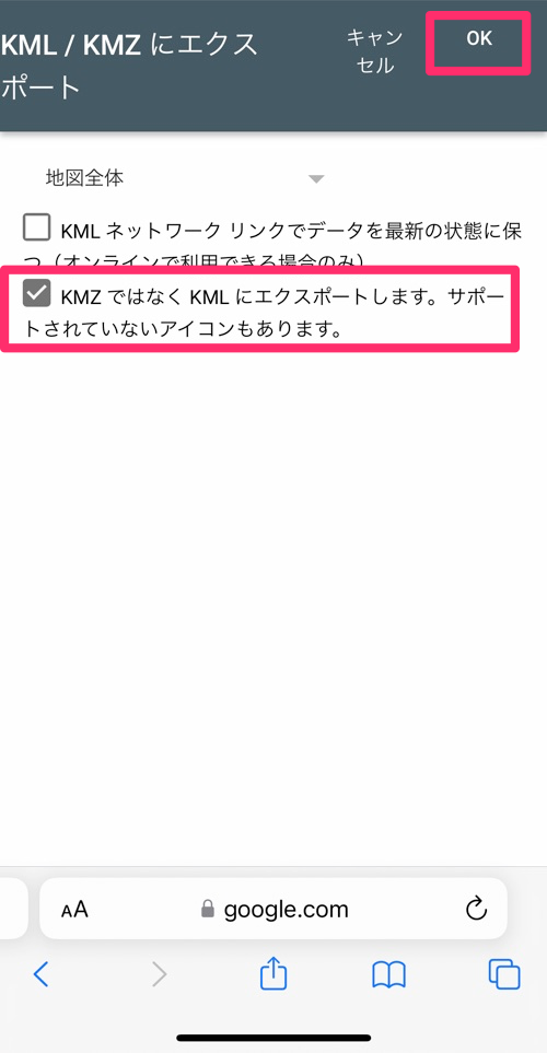
Download KML data.
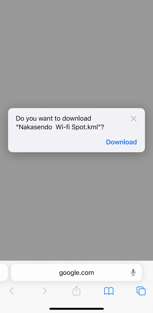
Tap the “↓” mark under the URL field and tap “Download
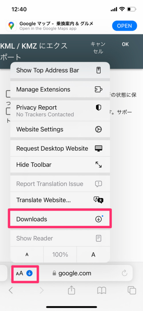
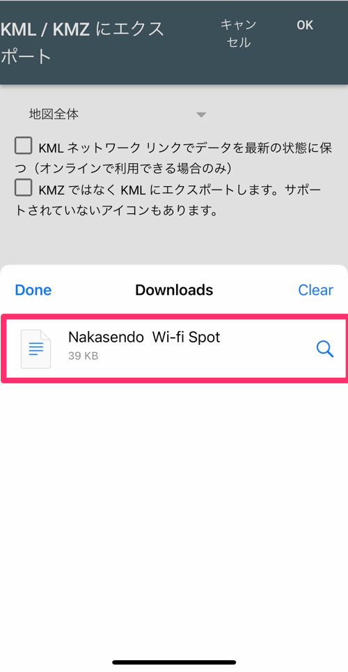
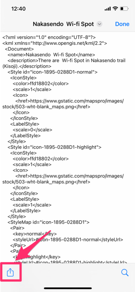
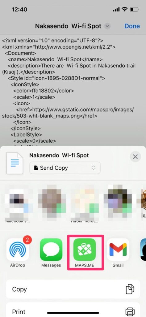
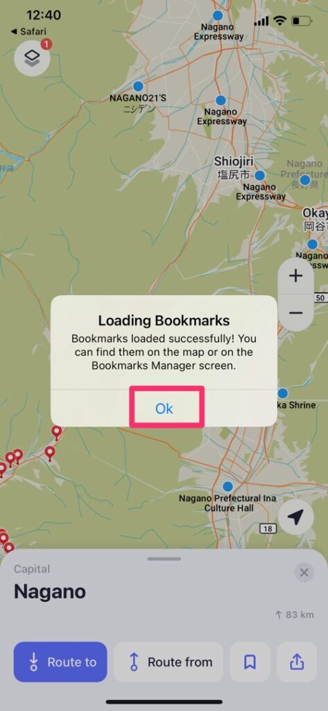
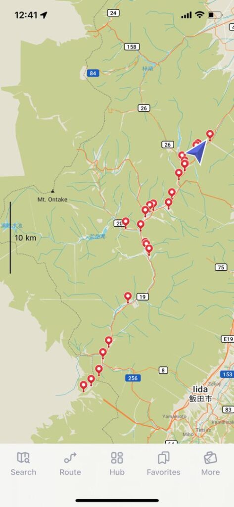
If the pin appears in Mapsme as shown in the image below, you have succeeded!
